
By Xuefei Shi
In January 2026, the New York Times (NYT) published an interactive report on “abnormal” Chinese fishing vessel formations in the East China Sea. More than 1,400 vessels, the newspaper claimed, had aligned in formations stretching roughly 200 miles, possibly rehearsing a maritime blockade. The images went everywhere, carried by a compelling securitization narrative.
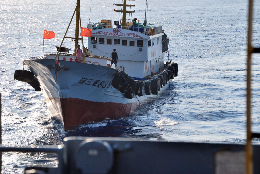
However, put this map in front of someone who studies fisheries governance in the Indo-Pacific, and the likely first reaction would not be alarm but skepticism. As any fisherman who knows what this part of the sea looks like in winter, this looked a lot like fishing.
A classic cartographic trick
Start with the map itself. The NYT visualization uses grossly oversized dots to represent each vessel. Scaled far beyond a ship’s actual footprint, those dots fill the empty ocean between vessels and create an artificial sense of linearity and geometric order that simply does not exist at vessel scale. Vessels separated by tens of miles appear to fuse into a seamless line. The “formation” was not at sea, but in the rendering.
This is a classic cartographic trick that uses size exaggeration to turn dispersed dots into a “pattern”. OSINT analysts on X (@Topol_MSS27, @giammaiot2, @CeciliaSykala) were among the first to question this and cross-checked it using data from NASA and marinetraffic.com (a professional ship tracking service), examined at proper scale and revealed random, scattered spatial clustering. Night-time light data, which had been effective in detecting fishing fleets off the Argentinian coast, would show up a genuine hundreds-of-miles-long formation, does not support the narrative either. NYT’s analysis relies entirely on automatic identification system (AIS) signals, with no triangulation from other tracking tools, a significant methodological gap for any claim with security implications.
Not a line, but several discrete clusters
The most powerful rebuttal to the blockade narrative is also the simplest. Zoom in, and the “line” falls apart. What the NYT map presents as a single, coherent formation is, on closer look, several discrete clusters of vessels, each in a different location for different reasons. They share only a longitude (125°E). The real question is, why here?
Cluster 1: The northeastern apex (~31°N, 125°E)
To understand why vessels concentrated here, it is necessary to know both the Zhoushan fishing ground and what 125°E means in this sea. Zhoushan, off the coast of Zhejiang province, is the largest fishing ground in China and one of the most productive in the northwest Pacific. Its northeastern boundary sits at roughly 31°N, 125°E, precisely where this cluster appeared. And 125°E is not just any line on a map. It marks the boundary between Chinese and South Korean fisheries jurisdiction. It marks the limit within which the coveted “authentic Zhoushan seafood” certification — a geographic indication that commands premium prices — is recognized. Chinese maritime authorities also use it as their effective management boundary. When conditions deteriorate at sea, they call vessels back within it, because monitoring and assistance beyond that line fall under South Korean control. And by no coincidence, 125°E sits right on the seasonal migration route of hairtail (Trichiurus lepturus), the fishery that draws this fleet every December through February.
Why crowd at that apex? Because the fish were just beyond it. Hairtail schools aggregate in the overlapping China–South Korea zone on the other side of 125°E, and vessels pushed as close as they could. When the weather deteriorated, most were called back (which can be corroborated with fishers’ social media posts during that period). Those who chose to stay and gamble for the catch, however, did not cross the line. They held position within the corner, on the Chinese side, where authorities could monitor them and where they could expect protection if anything went wrong. So, the cluster seen is not a formation pressing outward, but a group of fishers huddled at the furthest point they were permitted to be, waiting out the weather or working what fish they could reach.
Zoom into vessel movements and the blockade reading becomes even harder to sustain. Rather than fixed alignment, vessels show an oscillatory, looping pattern locally known as leidawang (雷达网, “radar net”), a hairtail-specific trawling technique in which vessels maneuver in circular or looping paths to work the net. A deeper dig using Global Fishing Watch data into the detected AIS signals also finds that some were transmitted from fishing gears.
Cluster 2: Smaller clusters south of the apex (~29–30°N)
South of the apex, several smaller clusters hug the same boundary for the same reason. When winter conditions deteriorated, fishers were called back, with no good reason to push beyond Chinese jurisdiction into rougher, less predictable waters.
Cluster 3: The southern clusters (~27–28°N)
The southernmost clusters are a different fishery, where vessels target swimming crabs and yellow croakers, in adjacent zones south of the Zhoushan system. They stop at 27–28°N to avoid entering Taiwanese fishing waters.
The response that never came
If 1,400 fishing vessels were genuinely rehearsing a blockade in the East China Sea, South Korea, Japan or Taiwan would have noticed. All run sophisticated maritime surveillance and have strong institutional incentives to respond to exactly this kind of activity. None issued a statement treating it as a security incident. There were no protests, no repositioned assets, and no emergency briefings.
Visibility is not verification
When maritime analyses carry security or policy implications, single-source remote datafication is not enough. AIS data gains meaning only when read alongside fisheries ecology, regional regulatory regimes, vessel monitoring systems (VMS), satellite imagery, and the kind of fisheries literacy that comes from actually knowing what hairtail fisheries look like.
None of this denies that China’s maritime militia is real, or that large-scale vessel mobilization is a legitimate concern. But AIS maps alone cannot tell the difference between a coordinated exercise and a few thousand fishermen chasing hairtail on a cold winter morning. Fishing vessels usually join militia training during moratoria. Claiming a large-scale maritime militia exercise during an active fishing season also reveals a basic misunderstanding of how the militia is organized.
In all likelihood, the East China Sea “line” was just a fishing ground. The lesson for policymakers, journalists, and researchers is simple. Before reading geopolitics into a map, ask who made it, how they render the data, and whether they know the fishery and local fish.
 Xuefei Shi is a fisheries and aquaculture policy specialist and an affiliated researcher at Chr. Michelsen Institute in Bergen, Norway.